
 EN
EN
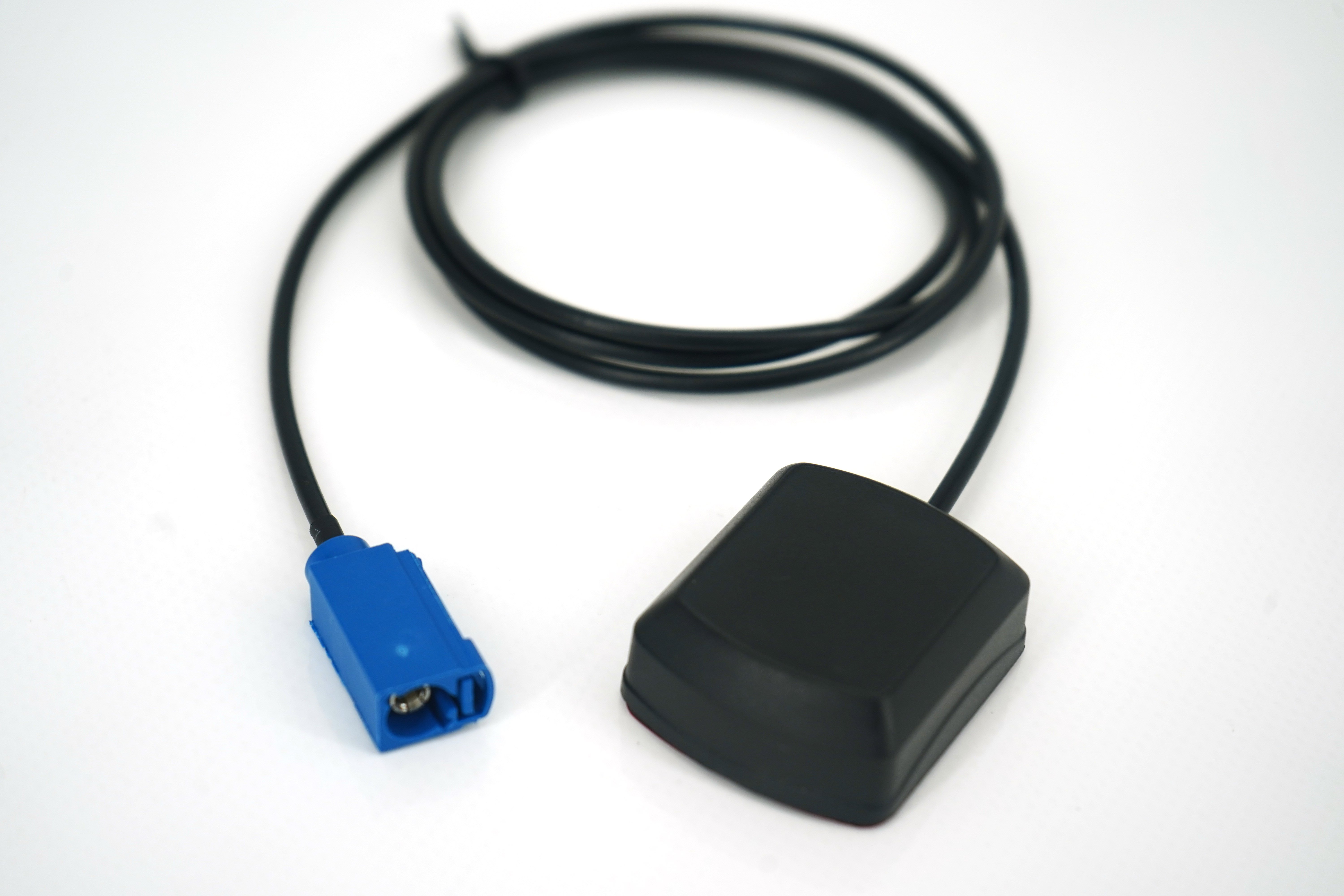
The precision GNSS antenna represents one of the most critical components in modern positioning and navigation systems, enabling organizations across industries to achieve centimeter-level accuracy in real-time applications. Unlike conventional GPS receivers that operate at meter-level accuracy, a precision GNSS antenna leverages advanced signal processing, multi-frequency reception, and carrier-phase tracking to unlock unprecedented locational intelligence. Understanding how a precision GNSS antenna works is essential for professionals in surveying, construction, agriculture, autonomous vehicles, and critical infrastructure monitoring who depend on reliable positioning data.

Modern precision GNSS antenna systems combine hardware innovations, algorithmic refinements, and constellation optimization to achieve positioning accuracy that was once reserved for laboratory environments. As we move through 2025, the evolution of precision GNSS antenna capabilities continues to accelerate, driven by expanding satellite constellation coverage, improved receiver chipsets, and integrated correction services. This article explores the fundamental mechanisms that make a precision GNSS antenna function, the key technologies embedded within these systems, and how organizations leverage this technology to solve complex positioning challenges in demanding environments.
Core Architecture of Precision GNSS Antenna Systems
Multi-Frequency Signal Reception in Precision GNSS Antenna Design
At the heart of every precision GNSS antenna lies the ability to receive and process signals across multiple frequencies simultaneously. A precision GNSS antenna typically captures signals from GPS, GLONASS, Galileo, and BeiDou constellations, each transmitting on distinct frequency bands including L1, L2, L5, and additional regional frequencies. This multi-frequency reception capability allows the precision GNSS antenna to mitigate ionospheric delays, the primary error source in single-frequency positioning. When a precision GNSS antenna processes dual-frequency or triple-frequency measurements, it can calculate the ionospheric correction in real-time, effectively removing one of the largest sources of positional error.
The antenna element itself consists of a patch or helical design that efficiently collects electromagnetic waves across the required frequency spectrum. Modern precision GNSS antenna units incorporate specialized ground planes, radiation patterns optimized for satellite geometry, and low-noise amplifiers that preserve signal integrity from the moment reception begins. The precision GNSS antenna's ability to lock onto weak signals, even in partially obstructed environments, depends critically on the receiver's tracking loop sensitivity and the antenna's gain characteristics across elevation angles.
Carrier-Phase Tracking and Ambiguity Resolution
Beyond basic pseudorange measurements, a precision GNSS antenna enables carrier-phase tracking, which observes the phase of the transmitted electromagnetic wave rather than merely detecting its presence. This precision GNSS antenna capability reduces measurement noise by a factor of one hundred or more compared to pseudorange-only positioning. However, the precision GNSS antenna receiver cannot determine which complete wavelength cycle corresponds to the initial reception, introducing the integer ambiguity challenge. Resolving these ambiguities—often numbering in the dozens or hundreds—is essential for the precision GNSS antenna system to transition from float solutions measuring decimeters to fixed solutions delivering centimeter or sub-centimeter accuracy.
Advanced precision GNSS antenna systems employ techniques such as rapid static positioning, kinematic surveying, and real-time kinematic (RTK) processing to resolve ambiguities within seconds or minutes. The precision GNSS antenna's performance in ambiguity resolution depends on the number of visible satellites, the geometry of that satellite constellation, and the quality of atmospheric modeling. When a precision GNSS antenna achieves an integer fix, the positioning accuracy jumps from tens of centimeters to centimeters or better, making this transition critical for high-precision applications.
Signal Processing and Error Mitigation in Precision GNSS Antenna Operation
Atmospheric Correction and Real-Time Kinematic Positioning
A precision GNSS antenna system must contend with multiple error sources beyond the receiver's control, including ionospheric refraction, tropospheric delay, and multipath reflections. Precision GNSS antenna technology addresses these challenges through correction services and integrated algorithms that estimate atmospheric conditions in real-time. Real-time kinematic (RTK) positioning represents one of the most effective applications of precision GNSS antenna technology, where a stationary reference station transmits correction data to mobile receivers. The precision GNSS antenna at the rover location combines locally observed measurements with the reference station's corrections, achieving positioning accuracy that approaches the precision achievable through post-processing methods.
Multipath mitigation stands as another critical challenge for precision GNSS antenna design and signal processing. Multipath occurs when satellite signals reflect off nearby structures before reaching the precision GNSS antenna's receiver, introducing measurement errors that can reach several centimeters. Modern precision GNSS antenna systems employ choke-ring designs, polarization filtering, and advanced receiver algorithms to suppress multipath signals. The precision GNSS antenna's ability to discriminate direct signals from reflected signals determines whether positioning accuracy remains at centimeter-level or degrades in urban canyons and near buildings.
Augmentation Systems and Correction Networks
Contemporary precision GNSS antenna installations often leverage augmentation systems that enhance positioning accuracy beyond what autonomous reception can achieve. Satellite-based augmentation systems (SBAS) like WAAS and EGNOS provide regional corrections broadcast through geostationary satellites, extending the reach of precision GNSS antenna corrections to continental scales. Ground-based augmentation systems (GBAS) focus on airport environments where precision GNSS antenna accuracy is critical for landing guidance and taxiway navigation. Network real-time kinematic (NRTK) systems operate across regions, with multiple reference stations computing atmospheric models that precision GNSS antenna users can access through cellular or internet connectivity.
Precise point positioning (PPP) represents another correction paradigm that delivers precision GNSS antenna accuracy without requiring a local reference station. PPP services provide precise satellite orbit and clock corrections, allowing a standalone precision GNSS antenna receiver to achieve decimeter to centimeter accuracy within minutes to hours. The precision GNSS antenna application determines which correction approach makes economic and operational sense, with RTK favored for real-time surveying and construction, while PPP suits applications tolerating longer convergence times.
Practical Applications and Integration Considerations for Precision GNSS Antenna Systems
Surveying, Construction, and Infrastructure Monitoring Applications
The surveying and construction industries depend fundamentally on precision GNSS antenna technology to establish accurate control networks, stake out building foundations, and verify final as-built dimensions. A precision GNSS antenna system reduces the time required for conventional survey crews while delivering results that meet or exceed traditional methods in accuracy. Construction sites increasingly deploy precision GNSS antenna receivers on heavy equipment, enabling machine control systems to guide dozers, graders, and excavators with sub-centimeter precision to grade specifications. The precision GNSS antenna's integration into these workflows has transformed productivity, particularly on large earthmoving projects where small deviations compound into significant material waste.
Infrastructure asset owners employ precision GNSS antenna monitoring to detect settlement, subsidence, or structural movement in bridges, dams, tunnels, and buildings. High-frequency precision GNSS antenna measurements, collected over weeks or months, reveal millimeter-scale movements that indicate developing structural issues. The precision GNSS antenna's all-weather capability and long-term stability make it superior to conventional surveying methods for continuous monitoring applications, where measurement comparability across years is essential.
Autonomous Systems and Emerging Technology Frontiers
Autonomous vehicles, whether ground-based delivery systems, agricultural equipment, or aerial drones, increasingly incorporate precision GNSS antenna receivers to achieve the positioning accuracy required for safe autonomous operation. A precision GNSS antenna system provides the primary localization source in open environments where satellite visibility is adequate, with other sensors providing redundancy and enhanced capabilities in degraded conditions. The precision GNSS antenna's role in autonomous systems extends beyond positioning to include heading determination through dual-antenna configurations that resolve the vehicle's orientation in addition to location.
Agricultural precision farming represents a rapidly growing application domain where precision GNSS antenna technology enables row-by-row guidance for planting, targeted pesticide application, and variable-rate fertilizer distribution. A precision GNSS antenna system allows farmers to operate with pass-to-pass accuracy of a few centimeters, reducing input costs while maximizing yield potential. As regulatory frameworks develop around autonomous agricultural equipment, precision GNSS antenna performance standards and reliability requirements become increasingly stringent.
FAQ
How does a precision GNSS antenna achieve centimeter-level accuracy?
A precision GNSS antenna achieves centimeter-level accuracy through a combination of multi-frequency signal reception, carrier-phase tracking, and correction services. By receiving signals on multiple frequencies, the precision GNSS antenna can calculate and remove ionospheric delay, the largest error source in standard positioning. Carrier-phase measurements reduce noise by two orders of magnitude compared to pseudorange alone, and resolution of integer ambiguities transitions the precision GNSS antenna system from decimeter to centimeter or better accuracy. Real-time kinematic or precise point positioning services further refine the precision GNSS antenna's solution by providing atmospheric and orbital corrections.
What environmental conditions degrade precision GNSS antenna performance?
Precision GNSS antenna performance degrades in environments with limited satellite visibility, including dense forests, urban canyons, and indoors where signal blockage is extensive. Multipath reflections from nearby structures introduce measurement errors that compromise precision GNSS antenna accuracy even when satellite signals are nominally available. Ionospheric storms and extreme atmospheric conditions can occasionally overwhelm the precision GNSS antenna's correction capabilities, though such events are infrequent. Dense foliage and heavy rain cause signal attenuation, reducing the precision GNSS antenna's ability to track weak signals and resolve ambiguities quickly.
What is the difference between RTK and PPP for precision GNSS antenna positioning?
Real-time kinematic (RTK) positioning requires a reference station transmitting corrections to the precision GNSS antenna rover in real-time, typically achieving centimeter accuracy within seconds. Precise point positioning (PPP) operates with a standalone precision GNSS antenna receiver that processes precise orbit and clock corrections, converging to decimeter to centimeter accuracy within minutes to hours without requiring a local base station. RTK is superior for applications demanding immediate high accuracy, while PPP suits remote locations and applications tolerating convergence time, as the precision GNSS antenna requires no infrastructure investment.